§1.4 · The developer’s own proposal, in their own words
They told the state they would build this “in concert with the Conservation Commission.”
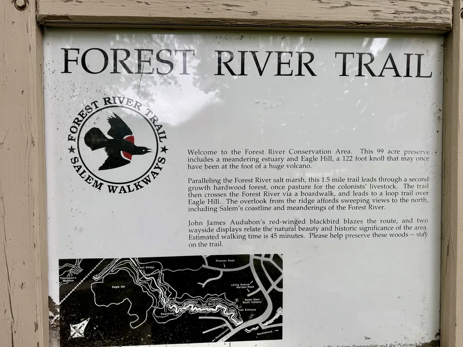
These are pages from the proposal AvalonBay and WinnDevelopment filed to win this public land in 2022. Read what they committed to. Then read what actually happened.
From the executive summary of their winning bid · p. 6
“The Development Team will enhance connectivity to the scenic Forest River Conservation Area Trailhead, through establishing new landscape areas and walking trails for the residents of the community and public to enjoy.”
The commitment to win the land was plural. Trails, not a trail. A network through the woods, for the residents and the public. The developer’s own words. The same plural commitment now described as “not feasible.”
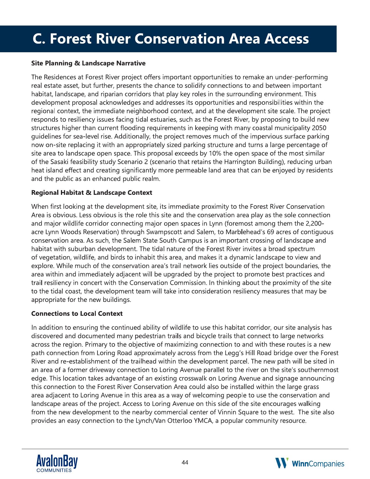
Proposal · p. 44 · “Forest River Conservation Area Access”
“The area within and immediately adjacent will be upgraded by the project to promote best practices and trail resiliency in concert with the Conservation Commission.”
A written commitment, on a binding public bid, to design the trail work with the Conservation Commission. Not to inform them after the fact. Not to ask later if convenient. In concert with.
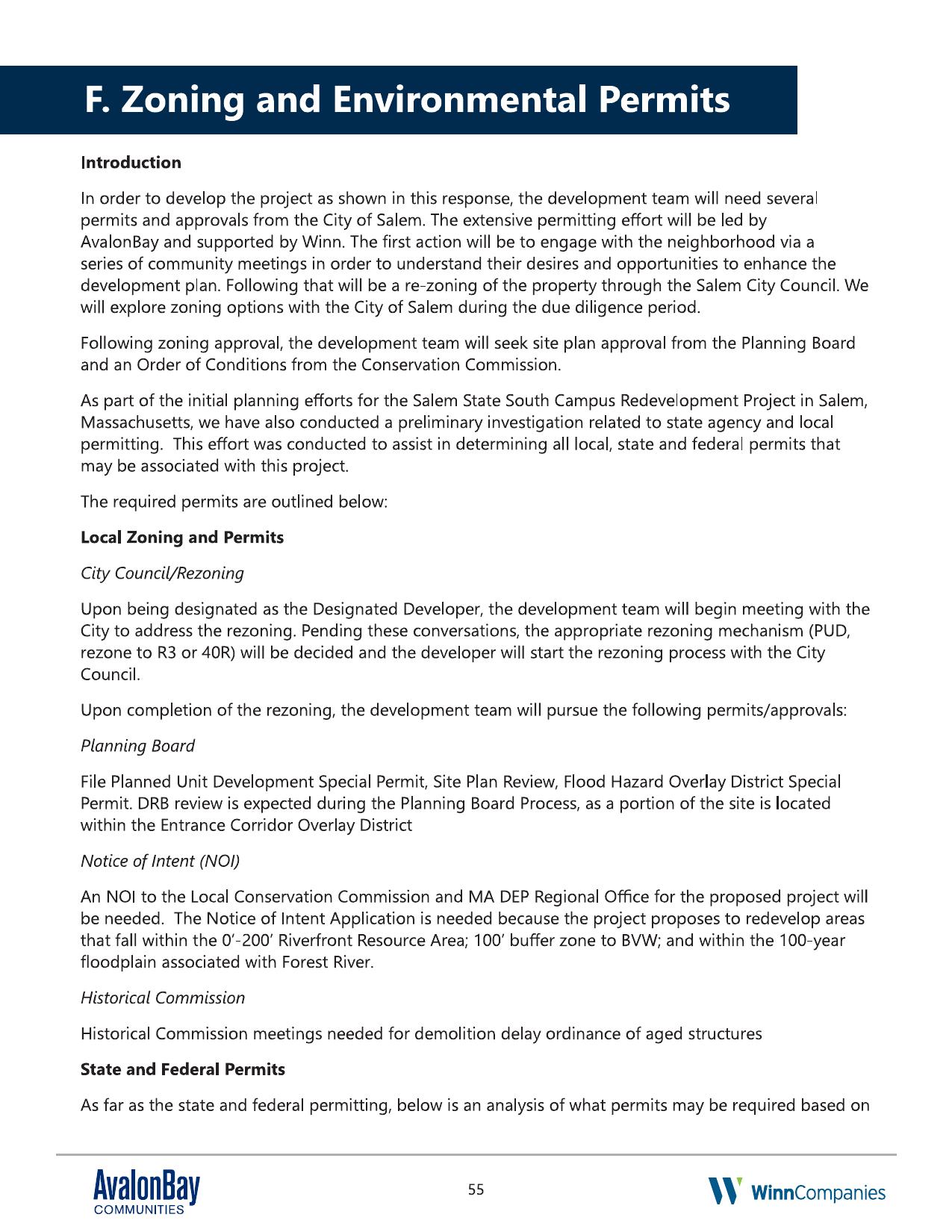
Proposal · p. 55 · “Zoning and Environmental Permits”
“The first action will be to engage with the neighborhood via a series of community meetings in order to understand their desires and opportunities to enhance the development plan… the development team will seek site plan approval from the Planning Board and an Order of Conditions from the Conservation Commission.”
A written commitment to talk with the neighborhood first, and to seek an enforceable Order of Conditions from the Conservation Commission as part of the project’s ordinary permitting path.
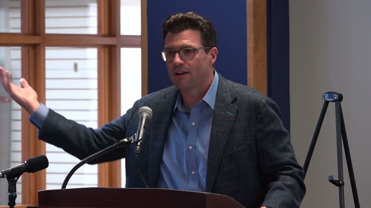
Third promise · on camera, to the neighborhood
“We need to… make sure that we have spots where folks that come to visit, you know, have ample parking and we’ll make sure we get that involved in one of our site plans.”
Dave Gillespie, AvalonBay, responding to a resident asking how the public would reach the Forest River trails. Aug 12, 2024 (timestamp 46:08).
And later in the same meeting, responding to Steve Dibble, a 35-year volunteer who helped build the existing FRCA trail network and a former Salem Conservation Administrator, asking for a permanent deeded public-access easement with parking:
“On the permanent access to the Forest River Conservation Area with parking, we’ve heard that loud and clear. We’re going to study it and get back to the community with a proposal.”
Same meeting, timestamp 68:48. Two years later, no proposal has come back to the community.
Now, what actually happened
Reality vs. p. 44 · May 19, 2026 ConCom hearing
Standing before the Commission, the developer called the promised trails “not feasible.”
WinnDevelopment’s representative told the Conservation Commission that the accessible footpaths and overlooks drawn on the winning Site Plan cannot be built. The Commission’s own vice-chair described it on the record as a bait-and-switch. The terrain has not changed since the developer first drew those trails in 2022. The same plan view with the same trail network was presented to the public at the August 12, 2024 community meeting, and again at the December 9, 2024 meeting at the Harrington Building with Mayor Pangallo, when the developer needed City approval of the 40R development. That was just 17 months before the same developer told the Conservation Commission those same trails are “not feasible.” What changed is that the land has now been awarded.
“I’ve heard from many people about this, asking what happened to the trail. It does feel like a bit of a bait and switch to say that it will have this trail, but then when the rubber meets the road, there is no trail.” Bart Hoskins, Salem Conservation Commission Vice-Chair, at the May 19, 2026 hearing, as reported in the Salem News, June 2026 (subscription).
And the public file does not show any pre-filing coordination of the trail or wetland-buffer design with the Commission. The promise was to design with the Conservation Commission. The reality was to present to the Commission, once, and to disown the trail network on the same day.
Sources: Salem Conservation Commission hearing, May 19, 2026 (DEP File #064-0825), Salem ConCom NOI public record. Hoskins quote as reported by Michael McHugh, Salem News, June 2026.
Reality vs. p. 55 + on-camera promises
The community meetings happened. The plan did not change.
The developer did hold the promised meetings. Residents raised specific, concrete concerns. Two years later, on April 23, 2026, the Planning Board approved Phase I of the project with no conditions imposed in response to the public record. The proposal promised meetings “to enhance the development plan.” The plan was not enhanced.
Source: Salem Planning Board approval, April 23, 2026. Public comment record on file with the City Clerk. All resident quotes below are verbatim from the Aug 12, 2024 community meeting (YouTube, timestamps in brackets).
Voice from the room · Aug 12, 2024 [64:15]
“This property is zoned single family… to give back to the developers something substantial, the developers should be giving something very big and very substantial back to Salem to protect our neighborhood.”
Steve Dibble. Former senior city planner. Former Conservation Administrator. Former Salem city councilor. Helped build the 200-ft Volunteers Bridge with neighbors over 35 years. Speaking at the August 12, 2024 community meeting on the South Campus redevelopment.
A point of language · from the developer’s own proposal
The Common was never a substitute for the trail network. It was promised in addition.
The developer’s own proposal and the DCAMM Selection Memo both describe the “enhanced connectivity” commitment as two distinct deliverables, joined by the word AND. Not or. Not either. Both.
Proposal, executive summary · p. 6
“The Development Team will enhance connectivity to the scenic Forest River Conservation Area Trailhead, through establishing new landscape areas AND walking trails for the residents of the community and public to enjoy.”
DCAMM Selection Memo · p. 8, “Connectivity”
“The development team will enhance connectivity to the scenic Forest River Conservation Area Trailhead, through establishing new landscape areas AND walking trails AND exploring multi modal connections to and from the site for residential and public use.”
The Selection Memo describes the landscaped Common as “the heart of the Forest River Residences… a center for the new community”, a residential amenity. The walking trails and overlooks were described separately, as a public-access deliverable for “people from all over the city.”
In the developer’s own words · Aug 12, 2024 [20:28]
Dave Gillespie: “That includes half acre, 20,000 square foot common space at the center, which is the gateway to the Forest River Conservation Area…”
A gateway is the entry point to something else, by definition. Gillespie’s own framing places the Common as the doorway. What lies beyond it is the existing Forest River Conservation Area trail network, the trails that volunteers built over decades, the 200-ft bridge that has been there since 1997. That access already exists.
Connectivity to the conservation area was not a throwaway extra. The DCAMM Selection Memo dedicated a full “Connectivity” comparison section to it, evaluating how each of the three competing proposals would deliver on the public-access commitment. It was a stated, evaluated public benefit that informed how Avalon and Winn won this land.
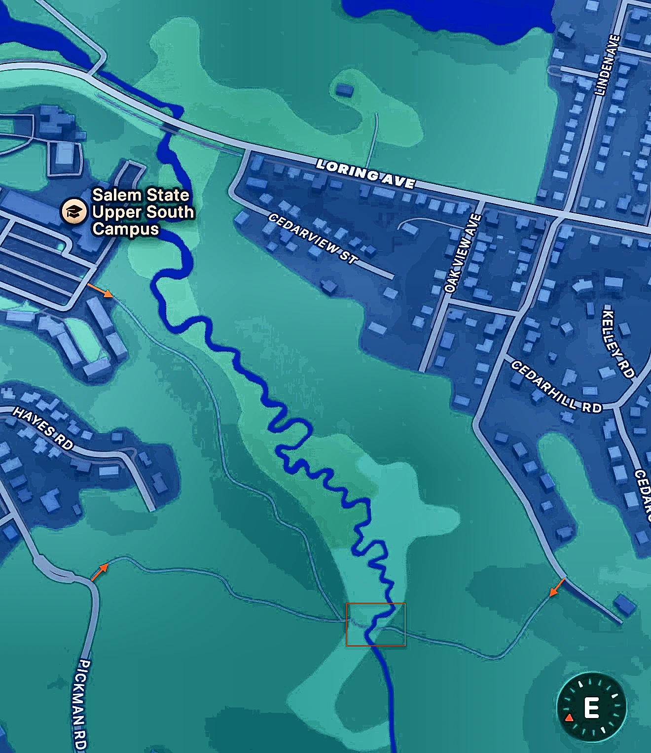
What the developer promised DCAMM was bigger than a gateway. The proposal and the Selection Memo both committed to “multi modal connections to and from the site for residential and public use.” The proposal specifically named a new path connection from Loring Avenue, at the existing crosswalk across from the Legg’s Hill Road bridge over the Forest River, sited along a former driveway alignment “parallel to the river on the site’s southernmost edge”, a riverbank walk leading from the Loring Avenue crosswalk past the river’s upstream beauty into the existing trailhead. The proposal itself described “welcoming people to use the conservation and landscape areas” with signage at the entry. A showpiece arrival, not a parking-lot scramble.
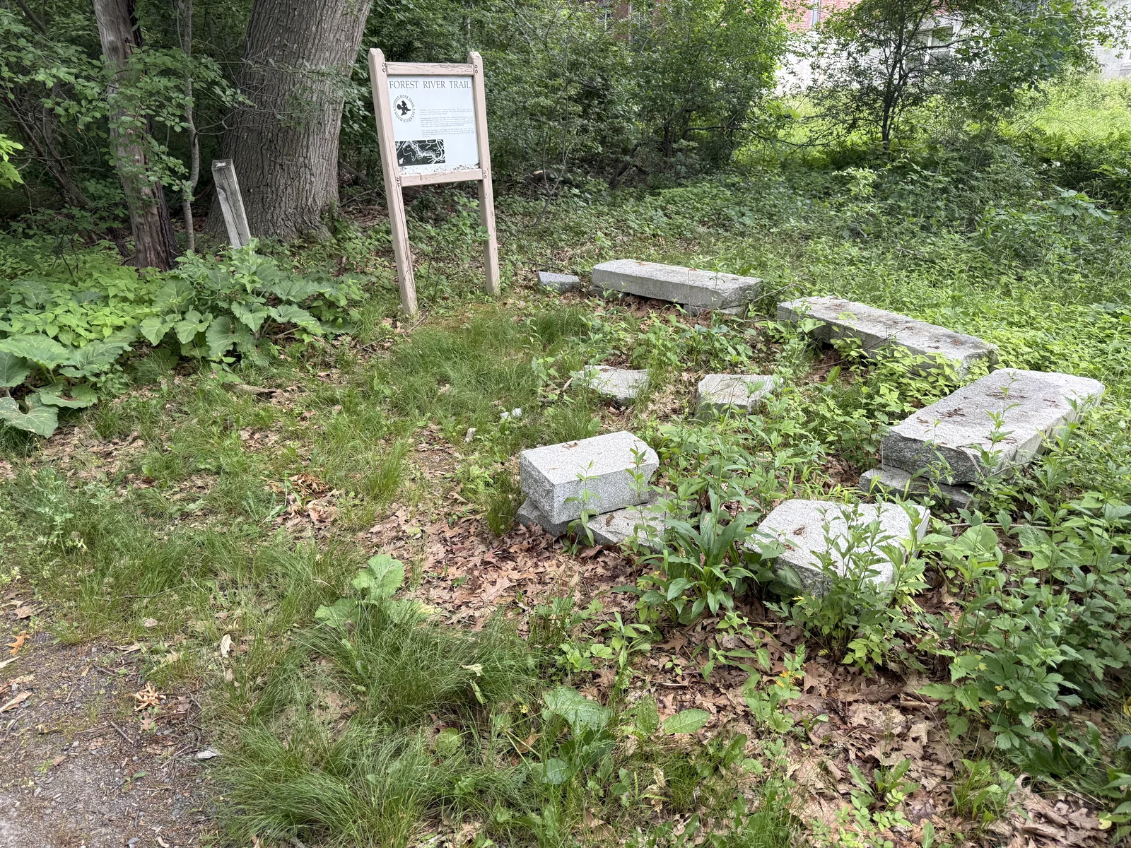
Through May, what was on the table was the opposite of that. The Loring path survived, but it ended in a busy parking lot, with no designated pedestrian path across. Visitors arriving from Legg’s Hill, the YMCA, or the wider Salem street network would have been dumped into vehicle traffic with no safe route to the trailhead. Residents said exactly that, at the hearing, in letters, and on this page.
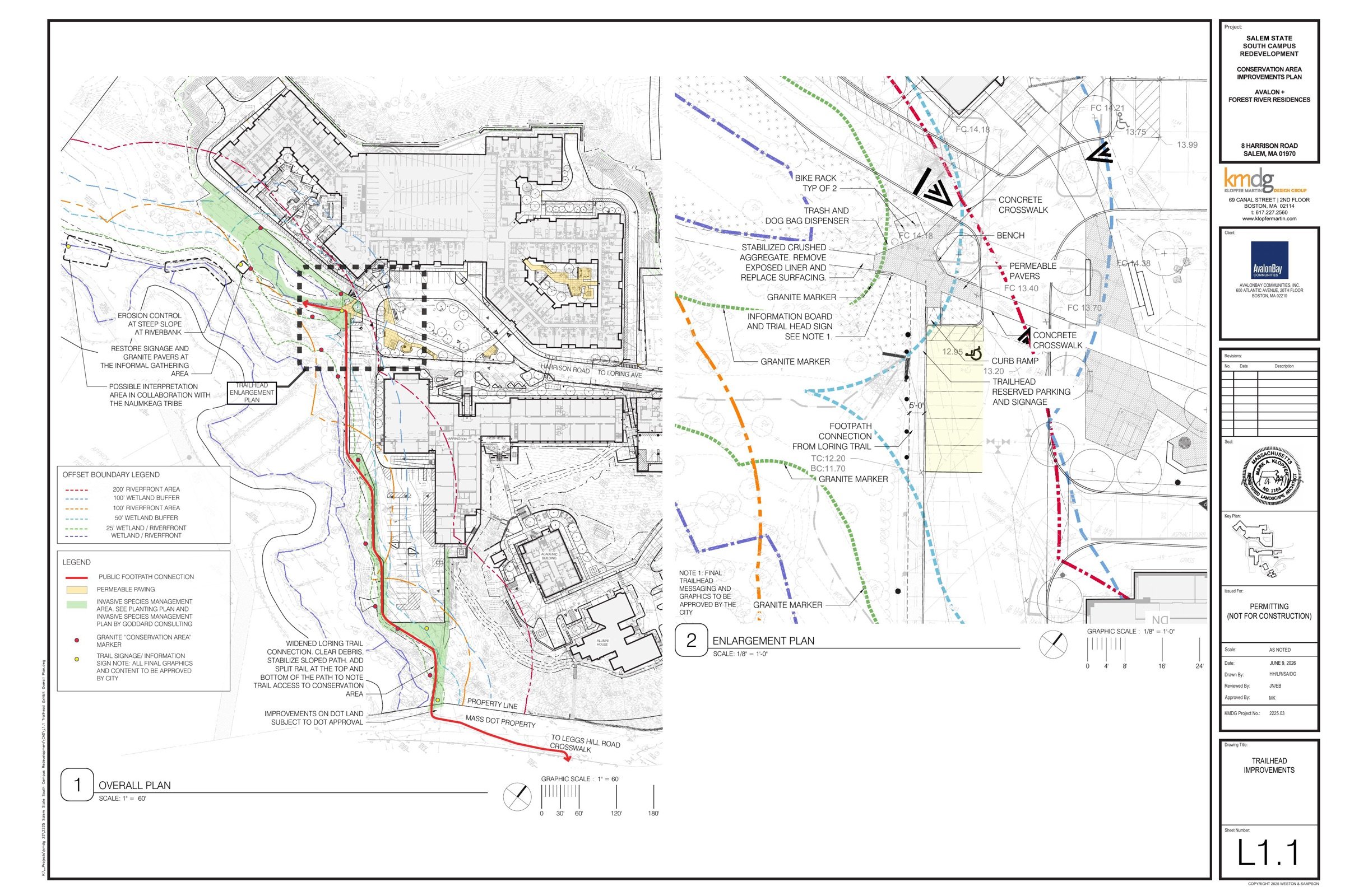
Then it changed. On June 9, the developer’s own supplemental filing committed to a 5-foot-wide footpath from Loring Avenue, behind the parking lot, to the trailhead, the safe route the public demanded, reconfiguring the parking to make room. The criticism on this page is now a commitment in their filing. What it is not, yet, is binding, and the path’s Loring Avenue end sits on MassDOT land, “subject to DOT approval.”
The pattern is still clear. The trail network and overlooks on the developer’s own parcel: still “not feasible.” The riverbank walk the proposal showcased: still absent. The connector path: conceded only after a continued hearing, a site walk, and sustained public pressure. Left alone, this developer delivers the bare minimum. Watched, they deliver what they promised. Keep watching.
Sources: AvalonBay + WinnCompanies proposal p. 6 and pp. 44, 55; DCAMM Selection Memo (Salem State University South Campus Disposition Evaluation Committee), September 15, 2022, p. 8; AvalonBay community meeting recording, August 12, 2024 (YouTube wN-N7xiluPA, 20:28).
Receipts
What residents said. What Avalon did.
Every resident concern below is taken verbatim from the Aug 12, 2024 community meeting. Every “reality” is verifiable in the public planning record.
What was said
What was promised
What happened
Developer’s framing · [17:38]
Dave Gillespie: “The Forest River Conservation Area, when we first visited this site, looked like an underutilized natural resource that the city of Salem could really use.”
Developer’s commitment · same moment
Gillespie: “One of the things that we focused on is how do we improve access to that and make a front door to that. So people from all over the city can come and say, ‘Hey, we have this great walking trail in the woods.’”
Reality · May 19, 2026
The same developer told the Conservation Commission the trails meant to be that “front door for the whole city” are “not feasible” to build. The framing that won the land has been disowned.
Resident concern · [34:34]
“One of the things that was discussed [in the Sasaki study] was a second point of egress or access. I don’t see that here.”
Holly Wolpert, 7 Cedar Street.
Developer response · [34:50]
“Any other access you can get out to Loring is environmentally sensitive… we really can’t do it feasibly. So Harrison Road is going to be our main point of entry and egress.”
Reality · 2026
Still one egress for up to 485 apartments. A real second egress would require disturbing the conservation buffer, which would trigger the full MEPA review the project has worked hard to avoid.
Resident concern · [28:25]
“Will you be required to file with the Department of Environmental Protection?… Have you identified the thresholds, and have you looked at the thresholds?”
Developer response · [28:50]
“Based on the project as it exists today, we don’t think we’re MEPA required to do MEPA.”
Reality · 2024-2026
Project impacts grew roughly 2.7× between filings. The state declined to reopen the threshold review under the “sufficiently related” doctrine. The full second-tier environmental review residents asked about never happened.
Resident concern · [45:56]
“I love that there’s going to be better access to the conservation area, but is there a place for me parking? How would everybody else in the city access it?”
Developer response · [46:08]
Dave Gillespie: “Make sure that we have spots where folks that come to visit, you know, have ample parking and we’ll make sure we get that involved in one of our site plans.”
Reality · April 23, 2026
The site plans show four parking spaces plus one ADA space at the trailhead. But the public has seen no recorded easement, no binding condition, no disposition-agreement language making any of it enforceable. A slide is not a promise.
Resident concern · [64:53]
“The Forest River Conservation Area trail needs to have permanent public access with parking… either deeded or permanent record easement… the trail that I spent 35 years building the bridges and the walkways with…”
Steve Dibble. Former senior city planner, former Conservation Administrator, former Salem city councilor. Helped build the 200-ft Volunteers Bridge with neighbors over 35 years.
Developer response · [68:48]
Dave Gillespie, in direct response to Steve Dibble: “On the permanent access to the Forest River Conservation Area with parking, we’ve heard that loud and clear. We’re going to study it and get back to the community with a proposal.”
Reality · two years later
No proposal has come back to the community. The site plans gesture at a handful of trailhead spaces, but the public has been shown no deed language, no recorded easement, and no binding condition that would make permanent access enforceable. Under M.G.L. c. 7C § 34, public-benefit commitments bind only when set forth in the deed, disposition agreement, or Order of Conditions. None of that exists in the public file.
All resident quotes verbatim from the public YouTube recording of the Aug 12, 2024 community meeting (video ID wN-N7xiluPA), with timestamps. Full transcript on file.
The developer’s own proposal set the standard. A binding Order of Conditions is the one venue that can hold them to it.
Sources: AvalonBay + WinnCompanies, “Salem State University South Campus” proposal (2022), pp. 44 and 55. Filed with the Massachusetts Division of Capital Asset Management and Maintenance (DCAMM). Public document.