July 23 · Planning Board
00Days
:
00Hrs
:
00Min
:
00Sec
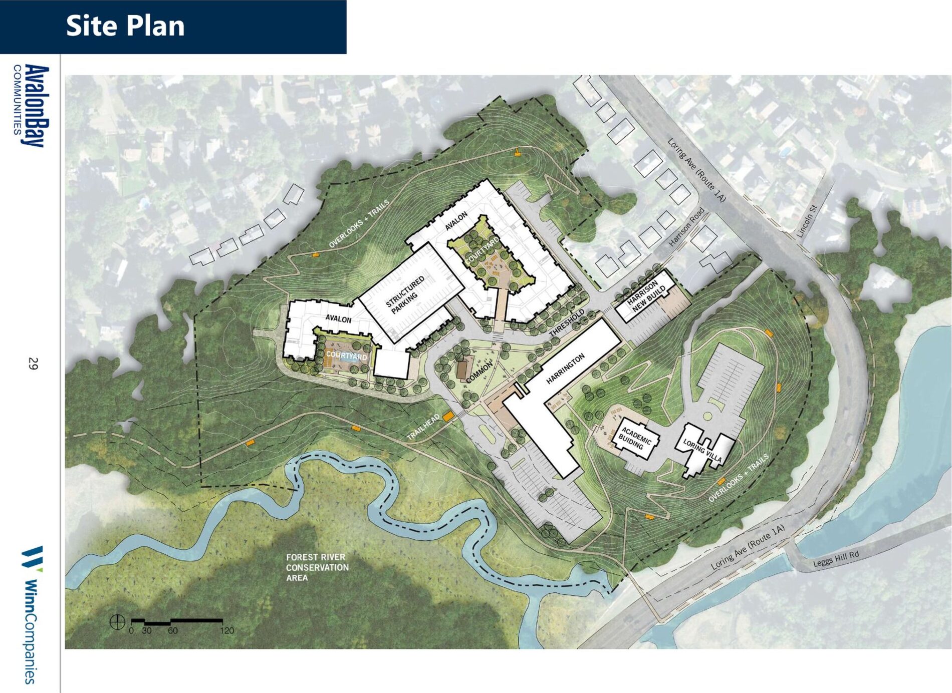
On July 9 the Board continued Winn Phase II to July 23. A draft decision is being written now.
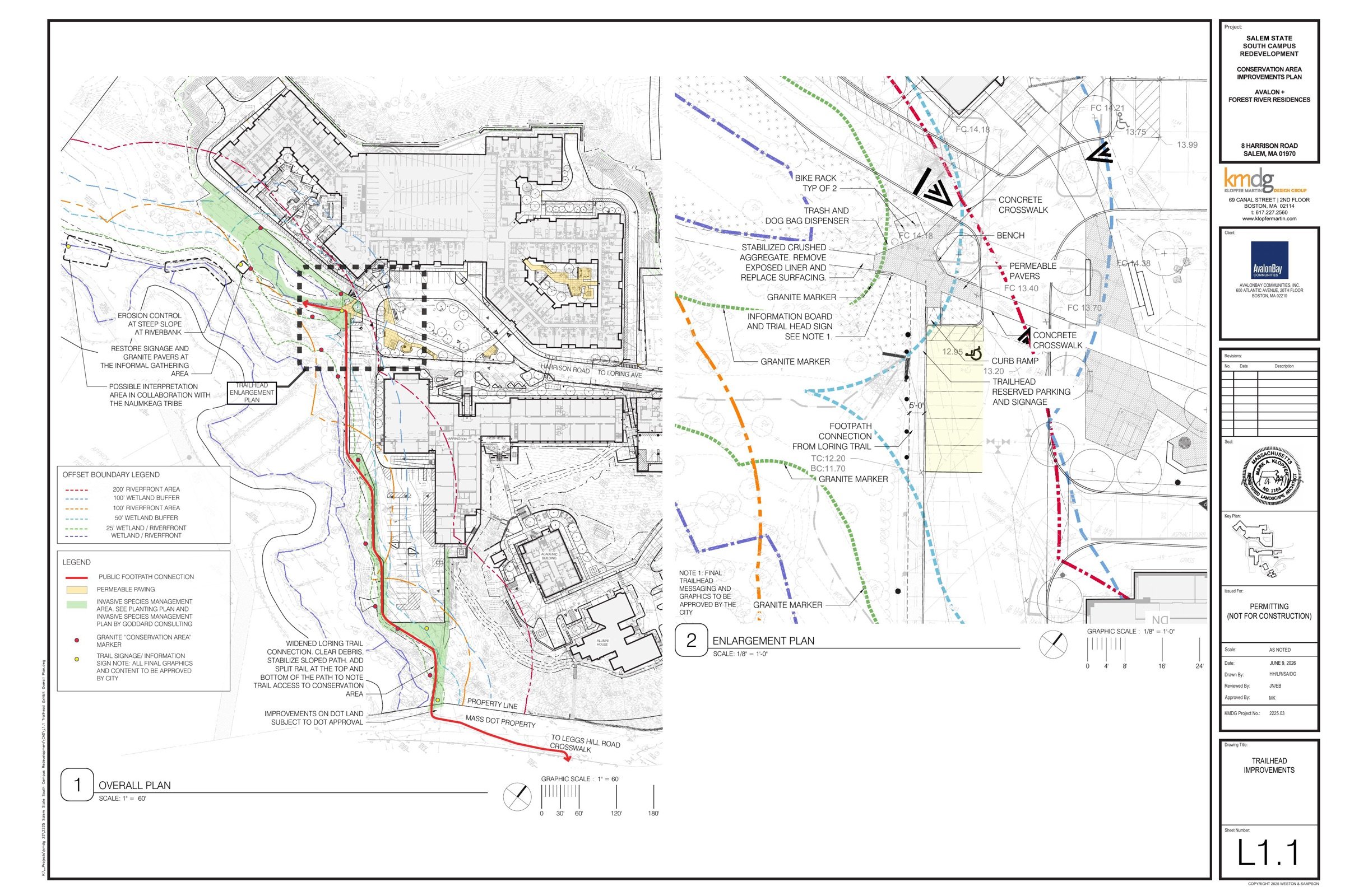
What we asked the Board for
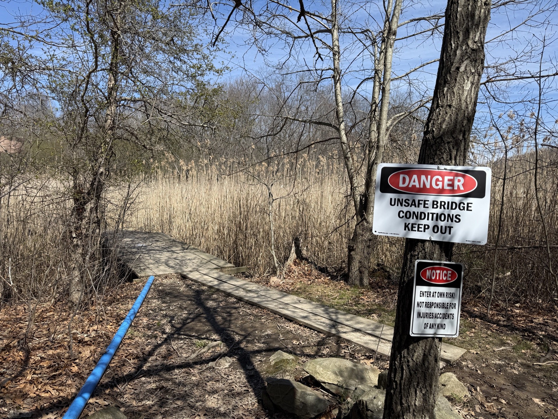
ConCom · Closed
Unanimously approved
The public hearing closed and the Order of Conditions passed.